Plan addresses flood of concern
Sanitary district works out response in case of 100-year event
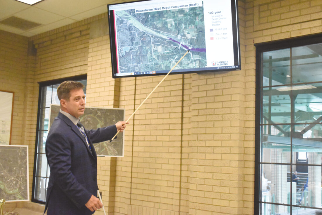
Staff photo / Mason Cole Michael McNinch, chief engineer for the Mahoning Valley Sanitary District, uses a series of maps to tell stakeholders what areas of concern would be for flooding during the MVSD’s flood plain management meeting last week.
WEATHERSFIELD — The Mahoning Valley Sanitary District is looking at how the district and surrounding areas would manage a devastating flood along the Mahoning River.
Such a rush of water theoretically would come over the Mineral Ridge dam and stem from the Meander Reservoir.
Representatives from cities, townships and organizations within Mahoning and Trumbull counties met with stakeholders Tuesday to discuss such a scenario.
They viewed a presentation from Michael McNinch, chief engineer of the MVSD, which provides water to 220,000 area customers; Tony Burgoyne, a representative from OHM Advisors in Akron; and Manogya Khanal, a representative from the engineering firm Gannett Fleming.
The engineering trio discussed what would happen at the dam in the event of a 100-year flood, which — according to statistics from the Federal Emergency Management Agency — would be about 5 inches of precipitation in a 24-hour period.
WHAT IF?
“The intent of this,” McNinch said, “is to capture, if there was a 100-year flood, which there is a 1 percent chance of happening every year, and MVSD had to release water from the reservoir to protect the dam — what are the downstream consequences of that?”
FEMA suggested that the MVSD devise the plan for a major flood, as no plan for such an event is in place.
MVSD designed the Floodplain Management Plan with matching funds from a High Hazard Potential Dam grant and an Ohio Department of Natural Resources grant. The plan is designed to mitigate and manage the impacts of flooding, reduce flood risks, improve public safety and safeguard the environment.
The plan comes as part of the district’s pursuit of grant money from FEMA to complete renovation to the dam, which originally was constructed in 1930.
According to the presentation, MVSD looks to construct a new auxiliary spillway to replace the existing twin spillways; modify the dam crest by extending the core wall; flatten the downstream slope of the dam; rehabilitate the concrete principal spillway; anchor the principal spillway, which is not anchored into the ground; replace the inflatable rubber bladder; construct new stairs and grading; upgrade the electrical and lighting components of the dam; improve the access roads around it; and install temporary erosion and sediment controls.
McNinch said some of the upgrades that MVSD is looking to do with the dam are simply because of its age, while others are due to regulatory changes on the state and federal level.
McNinch said the floodplain management plan was encouraged by FEMA as MVSD works to seek grant money — which will be awarded by the agency later in the summer.
BILLIONS OF GALLONS
McNinch said the reservoir can hold 10 billion gallons of water by itself, and an additional 1 billion because of an inflatable rubber bladder on top of the dam.
But McNinch said if the rubber bladder faces too much pressure, it can tear and cause significant damage to the dam. When MVSD anticipates a significant rainfall, one that could create enough pressure to damage the bladder, it is deflated.
The question posed at the meeting presented stakeholders with the worst-case scenario MVSD could envision involving the dam and the rubber bladder. That question was: What would MVSD, and its surrounding areas, do if a 100-year storm occurred, and the district had to deflate the bladder to prevent damage to the dam — pushing an additional 1 billion gallons of water into what would be an already flooded Mahoning River?
Burgoyne said in that event, the river could see no change in height, or it could see up to 2 feet of additional water.
Nevertheless, McNinch said the damage of a potential 100-year flood through the Mahoning River would be widespread.
“Just to give you some sort of an idea of everything that would be affected,” he said, “your phone lines, there are rail lines up and down both sides of the river, communication lines, internet and fiber optic, a lot of those run up and down the train tracks. Natural gas, underground electric.”
The engineers explained how a 100-year flood could impact nearby areas such as Niles, McDonald, Struthers, Campbell, Youngstown and Lowellville, by showing a series of landmarks on a color-coded map. McNinch said that in Niles, the city’s wastewater treatment plant would be underwater.
“There would be consequences,” he said. “Whether the wastewater plant is out of operation or where would the sewage go in that event.”
In Youngstown, McNinch said the city’s wastewater plant would be outside of the floodplain, but that rainfall could impact how workers are able to access the plant. He said the Youngstown Foundation Amphitheatre also likely would be underwater.
McNinch added that every bridge that the river passes under, including bridges on Interstate 80 and Interstate 680, could be impacted.
NOT TO SCARE
Burgoyne said the meeting was not intended to scare those in attendance, but rather to begin the process of formulating a plan in case of emergency.
“This is a precautionary measure,” he said. “The point is not to instill shock and awe here. It really is a rehabilitation measure to make sure we make the regulatory required improvements to the dam, but we have emergency management response plans in place in conjunction with Mahoning County, Trumbull County, the Ohio Department of Transportation, Ohio Department of Natural Resources, as well as FEMA.
“This is basically the coordination call to say, ‘Hey, we’re not proposing to have undue risk onto the assets down-river here, because of dam regulations. What we’re saying is that there could potentially be that, so we want to identify those potential sources now, so that we can plan accordingly moving forward.'”
Troy K. Rhoades, who was at the meeting as a representative of Ohio Edison and FirstEnergy, said that his company would need to know how the potential flooding could impact its substations and utilities.
“Our substations are in proximity to the old steel mills and stuff like that,” he said. “So we would want to know what that width (of the water) is so that we can make a determination about any kind of risks that we need to be prepared for.”
McNinch reiterated that concerns, such as those expressed by Rhoades, were the reason MVSD scheduled the meeting. Burgoyne said the stakeholder feedback about the plan was valuable, and after the presentation, all in attendance could take an online survey to share their opinions about the plan or place a sticky note on areas of concern on a physical map.
Local News

Creighton shares memories of a lifetime
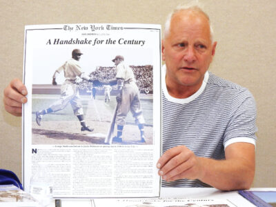
‘A Handshake for the Century’
Casting call
The driving force behind the formation of Warren and Akron
EDITOR’S NOTE: This is part of a weekly series on our region’s history coordinated by the Trumbull County ...
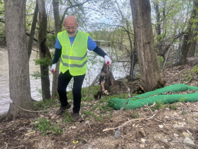
Volunteers show up for Earth Day cleanup
On the record: Weathersfield and LaBrae
Weathersfield WHAT: Township trustees meeting Tuesday PRESENT: Steve Gerberry, Ed Whittaker and Richard ...