
Plans for Warren marker progress
Trending
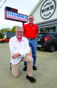
WARREN -- Greg Thumm gets pretty excited when he talks about a 1958 Youngstown Vindicator news article found among the items his late uncle, Karl Thumm, saved.
The article says one of Warren's great historical figures, General Simon Perkins, directed workmen around 1816 to erect a surveying monument in front of what is now Thumm's Bike and Clock Shop on West Market Street.
An engineer's monument, also called a benchmark, is an anchor point in the ground used to establish permanent geographical coordinates, elevations and legal boundaries, according to Wikipedia.
The article states that the monument bore the name "Connecticut Land Co." and the date, 1816. It also states that Karl Thumm, one of the founders of the Thumm Family's original business at the site, Thumm's Tire Shop, indicated he had seen the monument himself.
In 1909, Karl and his brother, August, established the tire shop, selling motorcycles, bicycles, motorcycle tires and car tires. The 1913 flood destroyed the tire shop. The business relocated across the street and became a bicycle shop in 1944 under August B. Thumm. His son, August F. II (Augie) started working at the shop in 1965 and became owner in 1989. He still runs the bike and clock shop today.
The 1958 article, whose author is not named, stated that the marker was important to the city because "the monument was said to have been the only correct and definite surveyor's mark in the city."
According to one surveying expert, surveying monuments erected in the early to mid-1800s throughout the expanding U.S. territory were important as "starting points for today's land measurements."
SOIL ADDED
The 1958 Vindicator article states that Karl Thumm recalled a time in early 1900 when the area where the tire shop would later be established was "filled in," raising the ground level about 18 feet. But the marker remained where it was -- about 18 feet below the new elevation of today's bike shop.
Karl Thumm said paving bricks were used to create a "manhole" down to the monument. Steel plates were placed over the top of the manhole.
The 1958 article states that if one were to look at the Reeves Apartment building on West Market Street across from the Thumm's current bike shop, one could see the difference between the parking lot behind the apartment and the elevation of Market Street. The Reeves building was demolished in 2025.
"It is because of the grading that the old engineer's monument of 1816 lay so far below the surface of W. Market St.," the article concludes.
Greg Thumm said last week the reason that part of West Market Street was filled in was because it is a peninsula. The Mahoning River flows around that part of Market Street on two sides. So when the river overflowed its banks, the peninsula flooded.
"When the river swelled, it would cross a couple hundred yards to the other neck of the river," Greg Thumm said. When the peninsula was raised, and West Branch Reservoir was built, the river was better controlled, he said.
SURVEYING MARKER FOUND
Thumm's tire shop moved to its present location in 1914, Greg Thumm said. His family made some changes to the home they acquired to house the shop, jacking it up and building a basement under it.
"And when they did that, they found that land marker," Greg Thumm said. "It was important enough they built a manhole tube with bricks that goes from this surveyor's marker all the way to the ground level," he said.
"And instead of just a manhole, they put some plates of steel over the manhole and then they built West Market street on top of it. If they ever needed to get to that marker, they could," he said last week.
In February 2025, Warren finalized a development agreement with the Springboro, Ohio-based Dillin Corp. to revitalize the area of West Market Street known as The Peninsula into a vibrant mixed-use community featuring residential, commercial and recreational spaces.
The project is expected to include over 400 residential units, a parking deck and 100,000 square feet of Class A office space. Dillin CEO Larry Dilling said a much stronger economic environment in the Warren area is the reason the project is being launched now.
The project will take the four-lane West Market Street down to two lanes, Gregg Thumm said. The first major phase was the installation of a footbridge over the Mahoning River from Perkins Park to land next to the Thumm Bicycle Shop, linking the park with the Peninsula.
Greg Thumm said that when he told the Dillin Corp. about General Simon Perkins' surveying monument 18 feet under the sidewalk, the company responded by sending a work crew with a commercial grade metal detector to the site.
PLATES FOUND
They found the metal plates, and there are plans now to create a unique historical viewing window where people will be able to look down at the 210-year-old historical artifact, Thumm said.
"They're serious about creating a half-inch thick glass with a bronze sign that says, 'If you look down here you can see this marker,'" Thumm said. Further steps are planned to "find" and "enshrine" the marker, Thumm said.
SIMON PERKINS
General Simon Perkins was born in 1771 in Norwich, Conn., to Capt. Simon Perkins, who died in 1778 while serving in the Continental Army during the American Revolution, and his wife, Olive Douglas.
Simon Perkins "spent his youth learning the trade of surveying and at age 24, he went to Oswego, N.Y., to survey and sell land for three years, according to a 2018 column in the Norwich (Conn.) Bulletin newspaper.
"From 1797 through 1831 he was the land agent in Ohio for the 0Erie Land Co., a subsidiary of the Connecticut Land Co." which was owned and organized by Gen. Moses Cleaveland of Canterbury, Conn.
Perkins established the company headquarters in Warren, Ohio. He served as the first postmaster in the Connecticut Western Reserve from 1801 to 1829. He married Nancy Ann Bishop in 1804 and became Brigadier General in the Ohio militia. In 1812, he commanded 400 men in defense of the northwestern area of Ohio from British and Native American attacks after the surrender of Detroit, the column states. His "General" designation is useful today, as his father and son were also named Simon Perkins. General Simon Perkins was auditor of Trumbull County from 1810 to 1812.
He established the Western Reserve Bank of Warren in the fall of 1813 and assisted in the founding of banks in Painesville and Norwalk.
Land records from 1815 show that he was one of the largest land owners in Ohio, paying one-eleventh of the property taxes of Portage County, Ohio. He bought 1,298 acres of land from Samuel Parkman. The land is now most of downtown Akron. He is considered the founder of Akron, according to a biography on the web site of the Ohio History Central. Perkins died in 1844 in Warren.
His oldest son, Col. Simon Perkins, moved to the Akron area in 1834 to oversee his father's holdings in the area.
General Simon Perkins built the Kinsman House on Mahoning Avenue downtown in 1832 as a wedding gift for his daughter, Olive Douglas Perkins, according to the Kinsman House web site.
The building, which is in front of the Warren Community Amphitheater, is home to the Warren Heritage Center, which "tells the story of the City of Warren and its role as the first economic and government center of the historic Connecticut Western Reserve," the center's web site states.
Warren City Hall, known as the Perkins Mansion, was built as the home of Henry Bishop Perkins, a son of General Simon Perkins. Warren's Perkins Park is named after the Perkins family. The city purchased it from the Perkins estate in 1931.